
Why haptic navigation systems matter for independent mobility
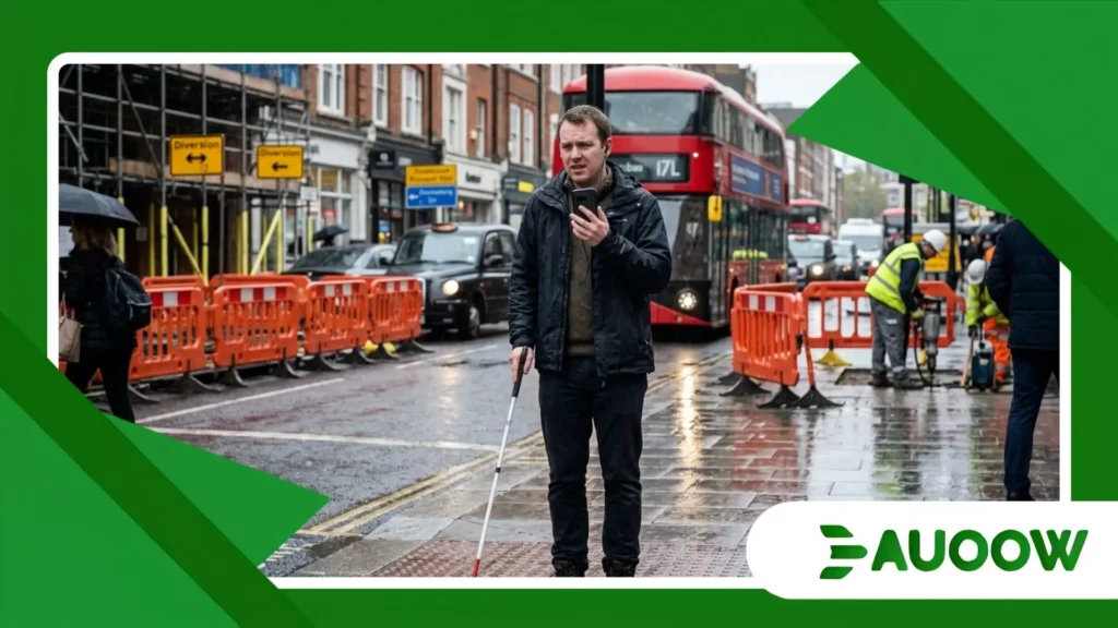
On a damp Tuesday afternoon in central London, Marcus steps off a double-decker bus into the continuous roar of rush-hour traffic.
Marcus, an engineer who lost his sight in his late twenties, knows the route to his office well. Today, however, severe roadworks have forced a temporary detour.
Pneumatic drills shatter the air, masking the ambient audio cues he usually relies on the familiar hum of a coffee shop condenser, the echoes bouncing off brick facades, and the chime of a pedestrian crossing.
A smartphone voice navigation app blares into his earpiece, but in this sonic crossfire, the synthetic voice competing with city noise feels less like guidance and more like cognitive overload.
Marcus pauses at the curb, navigating that familiar tension every traveler with low or no vision recognizes: the gap between moving through a city and experiencing it autonomously.
What happens in these moments is not merely a technical glitch; it points to a fundamental design blind spot.
For decades, traditional approaches to inclusive mobility have relied almost exclusively on two modalities: visual signifiers and acoustic warnings.
Yet, as modern urban environments grow louder, denser, and increasingly chaotic, the tactile channel our sense of touch remains one of the most underutilized pathways for spatial perception.
This is precisely why haptic navigation systems represent a pivotal evolution in personal autonomy, transforming how spatial information is delivered, processed, and felt without overwhelming remaining senses.
What Will You Discover in This Essay?
- The Sensory Overload Dilemma: Why ambient city noise limits traditional audio tools.
- The Philosophy of Tactile Direction: How non-visual, non-auditory cues restore situational awareness.
- A Legacy of Design Exclusions: Connecting early urban planning decisions to modern mobility barriers.
- Real-World Application: A closer look at non-intrusive wearable feedback in action.
- Comparative Assessment: Evaluating accessible transit frameworks across global cities.
- Reclaiming Autonomous Movement: Why true accessibility means moving without friction or permission.
Why Is Sight and Sound No Longer Enough in Modern Cities?
When examining public spaces, it becomes clear that many cities were designed around an assumption of sensory redundancy.
The expectation is that pedestrians can read signs, watch traffic signals, and listen for approaching hazards all at once.
When accessibility features are added, they often default to auditory overlays: beeping crossing signals, automated bus announcements, or voice-guided GPS applications.
Auditory space, however, is a finite resource. Many blind pedestrians rely deeply on hearing to map immediate surroundings through ambient acoustics detecting wall boundaries, judging distance through sound reflections, and monitoring traffic flows.
When a device speaks continuously into a user’s ear, it creates cognitive interference. It can mask the very micro-acoustics required for safety and situational awareness.
This is where haptic navigation systems offer a meaningful alternative by bypassing the acoustic bottleneck entirely.
By translating directional data such as turn-by-turn prompts, obstacle proximity, or path alignments into physical impulses against the skin, these tools communicate quietly.
A gentle pulse on the left wrist or a subtle vibration along a belt line allows the traveler to keep their ears open to the surrounding environment.
++ Why Local Governments Play a Critical Role in Accessibility
What Did We Get Wrong About Non-Visual Urban Design?
To understand why tactile feedback feels so transformative today, it helps to look back at how accessibility policies evolved.
During the late 20th century, landmark civil rights legislation such as the Americans with Disabilities Act in 1990 and the UK’s Disability Discrimination Act in 1995 pushed physical infrastructure to adapt.
This brought widespread installations of curb cuts, tactile paving ramps, and braille signage in public buildings.
These were vital steps forward, but they remained largely static. Accessibility was often treated as a series of physical checkpoints rather than a fluid, dynamic experience.
A tactile paving strip signals where a platform ends, but it cannot indicate that a service has been diverted or that temporary construction obstructs a walkway thirty yards ahead.
When digital navigation arrived, developers assumed that converting visual map interfaces into spoken turn-by-turn instructions would bridge the gap.
Yet this approach often forces individuals with visual impairments into a state of continuous active listening.
In conversations with urban planners and accessibility advocates, a consistent theme emerges: physical barriers were removed, but they were sometimes replaced by digital and cognitive ones.
By delivering spatial information through micro-vibrations, tactile systems address a long-standing oversight by offering dynamic, non-auditory orientation in real-time environments.
Also read: Why facial recognition accessibility raises daily access concerns
How Does Tactile Feedback Function in Daily Pedestrian Life?

Consider a university campus during class turnover thousands of students moving briskly across open plazas that lack defined footpaths or physical walls.
For Elena, a student with severe tunnel vision, navigating across a broad, open concrete square used to require frequent stops, zooming in on a phone screen held inches from her eyes, or seeking guided assistance.
During a pilot program evaluating wearable tactile bands, her daily routine shifted. Rather than listening to a synthetic voice repeating distances in yards, she uses two discreet wristbands linked to a spatial mapping application.
As she approaches her destination, the right wristband emits a soft, rhythmic pulse, indicating a subtle right turn ahead.
If an unexpected delivery cart crosses her path, a firm, immediate vibration across both bands prompts her to pause.
In practice, this non-intrusive feedback allows Elena to walk and hold a conversation with a classmate at the same time.
Her hearing stays tuned to the surrounding environment while her hands remain free. The technology works quietly in the background, serving as a genuine instrument of independent mobility rather than a constant distraction.
What Is the Real Infrastructure Barrier Holding Back Adoption?
If the benefits of tactile feedback are evident, why are these tools not yet standard across public infrastructure?
The answer largely lies in how transit authorities and municipal governments define accessibility in practice.
For generations, public policy has prioritized structural compliance over the actual daily experience of users.
A transit agency satisfies its legal obligations by providing auditory train announcements and tactile platform borders.
Integrating smart beacon networks or open-data spatial APIs which feed high-precision positioning data into personal devices is frequently viewed as an optional upgrade rather than an essential component of urban design.
Furthermore, when municipal budgets tighten, digital infrastructure and software integrations are often among the first items deferred.
Millions are routinely allocated for concrete and steel, while smaller investments in digital spatial infrastructure lag behind.
Yet high-precision mapping and spatial beacons are precisely what allow modern haptic navigation systems to function accurately in dense areas.
Without reliable, open-source municipal transit data, even advanced tactile hardware remains constrained by standard consumer-grade GPS, which often struggles in deep urban canyons or underground stations.
Read more: The rise of smart crosswalk accessibility in urban mobility plans
How Do Global Accessibility Models Compare in Practice?
To understand how different policy strategies shape real-world transit autonomy, it is helpful to examine how various metropolitan regions integrate tactile and digital solutions across their networks.
| Region / City Framework | Primary Assistive Strategy | Implementation Focus | Operational Strengths | Unresolved Structural Gaps |
| Traditional Compliance Model (Standard Urban Centers) | Physical tactile paving & audible signals at major junctions. | Minimum legal standards for physical infrastructure. | High reliability for basic physical safety at crossings. | Fails during unexpected detours, construction, or complex transit hubs. |
| Audio-Centric Transit Networks (Metropolitan Bus/Rail) | Continuous voice alerts, automated stop calls, audio apps. | High-volume acoustic information delivery. | Low hardware cost for the user; widely available broadcast data. | High cognitive overload; ineffective in noisy environments or for deafblind users. |
| Integrated Spatial-Haptic Ecosystems (Pioneering Smart Cities) | Open-data spatial beacons, micro-location APIs, wearable tactile devices. | Real-time, multi-sensory physical and digital integration. | Silent, highly intuitive, low cognitive load; works seamlessly indoors and outdoors. | Requires continuous municipal API maintenance and investment in sensor networks. |
A New Era for Spatial Equity: Rethinking the Architecture of Belonging
When stripped of technical jargon, discussions around sensory navigation are fundamentally about human dignity and the freedom to move through the world without unnecessary friction.
For generations, traditional systems have approached non-visual navigation as a challenge requiring direct intervention a guided arm, a companion, or an intrusive voice directing every movement.
However, true independence is not about being continuously managed; it is about having the personal agency to explore, make course corrections quietly, and experience the rhythm of a city on one’s own terms.
As urban infrastructure evolves, definitions of accessibility must extend beyond concrete ramps and audible crosswalks.
Integrating tactile feedback into the digital fabric of cities represents a meaningful shift toward universal design that respects human sensory limits and cognitive capacity.
When public transit networks, city planners, and software developers prioritize open, high-precision spatial environments, they do more than streamline foot traffic they help foster systemic equity and independence for millions of travelers navigating modern urban landscapes.
Frequently Asked Questions About Tactile Urban Navigation
How do tactile feedback devices differ from standard audio navigation apps?
Standard audio navigation apps rely on spoken instructions or tones, which require continuous auditory focus and can block out ambient environmental sounds.
Tactile devices deliver directional cues through subtle vibrations against the skin, keeping the user’s hearing free to monitor surrounding traffic and ambient acoustics.
Can tactile orientation devices work effectively inside underground transit stations?
Yes, provided the transit facility is equipped with micro-location infrastructure such as Bluetooth low-energy (BLE) beacons or ultra-wideband (UWB) transmitters.
Because standard GPS signals often fail underground, these localized beacon networks supply the precise positional data needed for tactile wearables to guide users through complex station corridors.
Are tactile navigation wearables helpful for people with combined hearing and vision loss?
Tactile feedback is particularly transformative for deafblind individuals, as it bypasses both visual and auditory pathways entirely.
By converting spatial and environmental data into haptic patterns, these devices offer an intuitive method for autonomous navigation that traditional accessibility tools cannot provide.
Do these modern tools replace the traditional white cane or guide dog?
No. Tactile navigation devices are designed to complement, not replace, primary mobility tools like the white cane or a guide dog.
While a cane or guide dog detects immediate physical obstacles directly in front of the user, tactile wearables provide macro-level directional orientation and spatial routing information.
What is preventing these technologies from becoming universally available?
The main barriers are fragmented municipal transit data, a lack of standardized indoor positioning infrastructure, and elevated hardware costs.
For these tools to reach their full potential, local governments must treat high-accuracy spatial mapping data as essential public infrastructure.
