
How Indoor Navigation Technology Is Improving Accessibility
Navigating standard indoor navigation technology: Beyond the Marble Hallways of Modern Public Space Indoor navigation technology has quietly transformed how we envision autonomy inside complex spaces, yet the experience of walking into a multi-story transit hub or a sprawling municipal center remains an exercise in subtle friction for millions.
Consider a woman with low vision arriving at a central train station on a damp Tuesday morning. Outside, her smartphone guided her to the exact curb with turn-by-turn precision via satellite signals.
The moment she steps under the concrete awning and through the glass doors, that reliable digital tether vanishes.
The blue dot on her screen freezes, drifts, or disappears entirely. She is left to parse an acoustic landscape of echoes, distant heels clicking on polished granite, and vague directional announcements.
The building is officially accessible by law, equipped with tactile paving strips and wide elevators, yet without real-time spatial orientation, every doorway presents a quiet test of persistence.
Key Perspectives in This Article
- The Indoor Blindspot: Why GPS stops at the threshold and how interior positioning systems fill the physical gap.
- Architectural Legacies: How historical design choices continue to shape modern orientation barriers.
- The Data Infrastructure: Why mapping physical interiors requires long-term public maintenance, not just hardware installations.
- Policy vs. Practice: Moving beyond baseline compliance toward functional, everyday spatial equity.
What standard spatial discussions rarely examine is why our digital infrastructure stops precisely where human life becomes most concentrated.
For decades, urban planning treated spatial navigation as a problem solved at the city scale.
We mapped streets, highways, and bus lines, assuming that once a citizen crossed a threshold, human intuition would carry them the rest of the way.
But as airports, hospitals, university campuses, and civic offices expanded into massive internal ecosystems, that assumption cracked open.
The physical barriers did not vanish; they simply moved indoors, creating quiet thresholds where independent movement often stalls for visitors trying to find their way through complex public buildings.
Why Do Modern Buildings Still Disorient Us?

To understand why interior navigation remains complex, we have to look closely at the physical materials surrounding us.
Global Positioning System (GPS) signals rely on clear lines of sight to satellites orbiting high above the Earth.
Steel beams, reinforced concrete slabs, and energy-efficient window coatings reflect or block these high-frequency signals.
When you step inside a multi-story medical facility or an underground subway exchange, satellite accuracy drops from a few meters to total uselessness, leaving mobile devices unable to pinpoint a user’s exact physical location within the structure.
For decades, the standard response was physical signage: overhead directional boards, color-coded floor strips, and braille plaques mounted beside office doors.
While essential, static physical signage carries built-in limitations. It cannot adapt to real-time closures, temporary detours, or crowded hallways.
Nor can it offer tailored spatial guidance to someone navigating in a wheelchair who requires step-free routing, or to a visually impaired visitor who cannot read an overhead board located twenty feet above the floor in a bustling concourse.
The gap between entering a building and successfully finding a specific office or clinic highlighted a major flaw in universal accessibility design.
A space can fulfill every physical code requirement on paper while remaining practically unusable for someone who cannot determine which hallway leads to an accessible elevator or a quiet reception desk.
++ How beach access mats improve seaside visits for wheelchair users
How Are Interior Positioning Systems Changing Spatial Autonomy?
When we look at the evolution of assistance tools, indoor navigation technology represents a major shift from passive structures to active spatial awareness.
Rather than relying on a single distant satellite signal, modern interior networks combine multiple short-range signals, localized sensors, and spatial data maps installed directly within the building’s architecture to establish continuous positioning.
These technologies work together quietly behind the scenes:
- Bluetooth Low Energy (BLE) Beacons: Small, battery-operated transmitters mounted on walls or ceilings emit light radio pulses. A smartphone receives these pulses, measures signal strength, and calculates exact indoor position within a few steps without compromising personal privacy.
- Wi-Fi Round Trip Time (RTT / FTM): Modern network routers measure the exact time a signal takes to travel to a device and back, determining distance accurately across large open spaces without requiring active connection logins.
- Ultra-Wideband (UWB): Operating across broad radio frequencies, UWB offers centimeter-level accuracy, allowing software to identify not just which room a user is in, but which specific service desk or office door they are facing.
- Inertial Measurement Units (IMU): Built directly into mobile devices, internal accelerometers and gyroscopes track movement speed and direction between signal updates, maintaining continuity even when radio signals fluctuate or temporarily drop.
In practice, these systems translate complex structural layouts into personalized audio cues, haptic vibrations, or clear high-contrast visual routes.
A visitor with visual impairments can receive subtle spoken feedback through headphones regarding upcoming level changes or obstacles, while someone using a motorized wheelchair receives paths that bypass stairs and heavy manual doors entirely.
What Does Historical Planning Teach Us About Access?
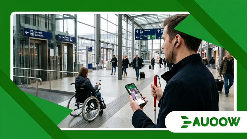
There is a structural detail that often gets overlooked in current discussions about assistive software: our physical infrastructure was rarely designed with spatial flexibility in mind.
During the mid-twentieth century, civic architecture prioritized grand scale, monumental stairs, heavy doors, and deep central corridors meant to project institutional authority rather than support fluid human movement.
When disability rights advocates secured landmark legislation in the late twentieth century such as the Americans with Disabilities Act or equivalent statutory frameworks across Europe and Asia the focus was naturally on physical retrofits.
Civil engineers poured concrete ramps, widened doorway frames, and installed tactile floor indicators to meet baseline standards.
However, physical retrofits only solved part of the equation.
A ramp installed at the far rear entrance of a government agency provides physical entry, but if the internal layout features confusing corridors without clear directional markers, the building remains functionally exclusionary for visitors unfamiliar with the floor plan.
The historical pattern is clear: infrastructure changes slowly, but digital layers can adapt instantly.
By overlaying dynamic spatial mapping onto existing architectural structures, indoor navigation technology bridges the historical gap between rigid physical design and modern expectations of universal autonomy.
Also read: Why facial recognition accessibility raises daily access concerns
What Happens When Facilities Adopt Digital Mapping in Practice?
To understand how spatial data mapping changes human outcomes, consider a real-world case at a major regional healthcare facility serving over two million patients annually across interconnected wings.
The hospital complex consisted of four interconnected wings built across three distinct decades.
Elevators in Wing A did not connect directly to specialty clinics in Wing C, forcing visitors to cross long concourses on specific floor levels.
For years, the facility relied on volunteers, information booths, and color-coded floor paths painted directly onto tile flooring to help people find their destinations.
Despite these physical markers, missed appointments and patient distress remained persistent problems.
The facility conducted an internal review and discovered that over thirty percent of missed appointments were tied directly to navigation difficulties within the building itself, as patients with various constraints spent excessive time trying to find check-in desks.
The facility installed a network of low-profile BLE beacons across all four wings and mapped the interior down to precise accuracy.
The resulting navigation system was integrated directly into the hospital application and made available on accessible touchscreen kiosks at every major entrance to support independent travel.
When patients arrived, they could select personalized navigation profiles tailored to their immediate physical and sensory needs:
- Step-free routing: Prioritizing wide elevators, automatically avoiding heavy manual doors, and identifying resting benches along the route for those with fatigue.
- Audio-guided pathfinding: Providing continuous acoustic descriptions of surroundings for visually impaired users to ensure safe and confident movement.
- Low-stimulation paths: Guiding neurodivergent patients through quieter corridors away from noisy waiting areas and crowded main concourses.
Within months of deployment, late arrivals dropped noticeably, and patient distress metrics decreased significantly across surveyed clinics, proving that digital tools can transform operational accessibility without altering physical walls.
Read more: The rise of smart crosswalk accessibility in urban mobility plans
Who Benefits from Interior Positioning, and Who Risks Being Left Behind?
When observing technological rollouts across public infrastructure, a recurring pattern emerges: innovations intended for specific accessibility needs often improve spatial experiences for the broader public, while simultaneously revealing new digital divides that require careful management.
The broad benefits are clear. A clear interior positioning system that guides a visually impaired visitor through an airport terminal also helps a parent with a heavy stroller locate an elevator, aids emergency personnel arriving in unfamiliar buildings, and assists delivery drivers navigating complex administrative structures.
This phenomenon demonstrates that accessible infrastructure consistently serves society as a whole.
Yet, a deeper examination reveals critical questions about who maintains access when physical environments change over time.
If a venue deploys high-end digital spatial mapping but fails to keep the underlying spatial data updated when a corridor is closed for maintenance, the reliance on digital wayfinding can create new hazards.
Furthermore, systems that depend entirely on high-end smartphones risk excluding individuals who rely on older hardware or who lack reliable mobile data subscriptions.
True equity requires that digital tools enhance physical wayfinding rather than replacing fundamental static markers, ensuring everyone retains the ability to navigate safely regardless of their technological access.
Navigating Technical and Policy Approaches
Building a reliable interior wayfinding framework requires selecting appropriate spatial mapping systems based on physical environment demands, operational budgets, and long-term maintenance capabilities.
| Technology Type | Primary Range / Accuracy | Best Suited Physical Environments | Maintenance & Operational Considerations |
| Bluetooth Low Energy (BLE) | High (1 -3 meters) | Multi-story offices, transit hubs, university campuses | Requires periodic battery replacement (2 – 5 year lifespan); low overall cost |
| Ultra-Wideband (UWB) | Very High (10-30 cm) | Specialized medical centers, complex industrial facilities | Requires dense hardware installations; higher initial capital expenditure |
| Wi-Fi Ranging (FTM) | Moderate (2 -5 meters) | Large retail concourses, international airport terminals | Uses existing Wi-Fi network infrastructure; requires modern routers |
| Magnetic Field Positioning | Moderate (1 – 4 meters) | High-density steel buildings, deep underground hubs | Zero hardware installation; requires detailed geomagnetic mapping of space |
What Changes After Systems Are Installed?
When public and private spaces embrace comprehensive indoor spatial data, the shift extends far beyond simple directional apps. The broader social impact shows up in everyday autonomy across diverse populations:
- Restored Personal Agency: Individuals navigate complex venues independently without having to ask staff for directions at every intersection or feeling dependent on others.
- Adaptive Barrier Management: Temporary hazards such as out-of-service elevators, wet floors, or construction zones are updated instantly in digital spatial maps, preventing users from encountering sudden dead ends.
- Data-Driven Urban Planning: Facilities gain anonymized insights into spatial bottlenecks, helping managers identify where physical ramps, wider paths, or clearer physical signage are needed most to improve overall flow.
Reimagining the Thresholds of Public Space
The evolution of modern spatial tools reminds us that accessibility is never a finished project, but rather an ongoing commitment to human dignity, equality, and inclusion.
Buildings are dynamic environments, and human needs are wonderfully diverse, requiring thoughtful intersections between physical architecture and responsive digital layers.
Installing physical ramps and elevators marked an essential first chapter in civic inclusion; ensuring that everyone can understand, navigate, and move through those spaces with confidence, independence, and absolute ease forms the next vital frontier.
When we integrate accurate indoor navigation technology into the fabric of our public life, we do more than simply guide people from one coordinate to another across a complex floor plan.
We signal a deeper cultural truth: that every visitor, regardless of physical or sensory ability, truly belongs in the space, deserves seamless access, and can move through our shared world with total autonomy, dignity, and peace of mind, transforming public architecture into a genuinely welcoming environment for all members of society.
Frequently Asked Questions
Do users need a continuous internet connection for indoor positioning software to work?
Many modern navigation applications download structural maps of a facility locally to the user’s device upon arrival.
Once downloaded, internal positioning hardware such as Bluetooth beacons and internal phone sensors can guide the user through the building even if cellular data or local Wi-Fi connections drop inside thick concrete structures.
How does indoor location software protect personal user privacy?
Standard positioning architectures utilize passive broadcast methods.
Bluetooth beacons and Wi-Fi access points continuously broadcast directional signals outwards, but they do not actively record or track individual user identities.
The user’s mobile device receives these signals and processes position calculations locally on the phone itself, keeping movement history private unless the user explicitly chooses to share location data.
Can indoor location tools assist emergency evacuation procedures?
Yes. Modern emergency management frameworks are increasingly integrating indoor spatial data with building control systems.
In the event of an emergency, system administrators can send real-time alerts that automatically route individuals away from smoke, fire hazards, or damaged stairwells, guiding users to accessible emergency exits based on their specific physical mobility profile.
Is indoor navigation technology mandatory under current accessibility laws?
While traditional civil rights laws mandate physical access features such as ramps, elevators, and braille signage they do not explicitly require digital indoor positioning systems in every building.
However, regulatory frameworks are evolving, and an increasing number of public transportation authorities, municipal facilities, and healthcare systems are adopting digital mapping as a standard operational requirement to satisfy broader non-discrimination mandates.
